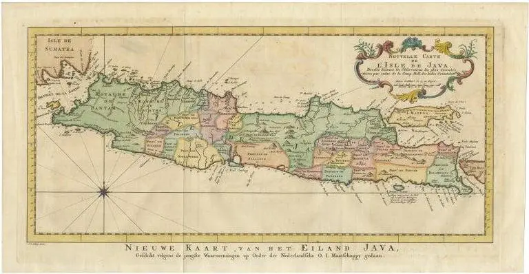
Antique map indonesia titled ‘nouvelle carte de l’isle de java – nieuwe kaart, van het eiland java’. Chart of the island of java, depicting soundings around the coast, all principal harbors, rivers and elevations, bays and points, settlements and provinces. Included are madura, bali, sunda strait and the southeastern tip of sumatra. This map originates from the dutch edition of ‘histoire generale des voyages, ou nouvelle collection de toutes les relations de voyages (.)’. Artists and engravers: made by j. Van schley after j.n. Bellin. Jacques nicolas bellin (1703 – 1772) was a french hydrographer, geographer, and member of the french intellectual group called the philosophes. Artist: made by j. Van schley after j.n. Bellin. Jacques nicolas bellin (1703 – 1772) was a french hydrographer, geographer, and member of the french intellectual group called the philosophes. Condition: very good, please study image carefully. Date: c.1770 overall size: 49 x 25.5 cm. Image size: 43.5 x 20.5 cm. See less
- Dimensions
- 9.84ʺW × 19.29ʺH
- Item Type
- Vintage, Antique or Pre-owned
Shop Sustainably with Chairish
- Materials
- Paper
- Condition
- Unknown, Some Imperfections
- Color
- Condition Notes
- Very Good — This vintage item has no defects, but it may show slight traces of use.